The various analyses in the report rely on different geographical boundaries.
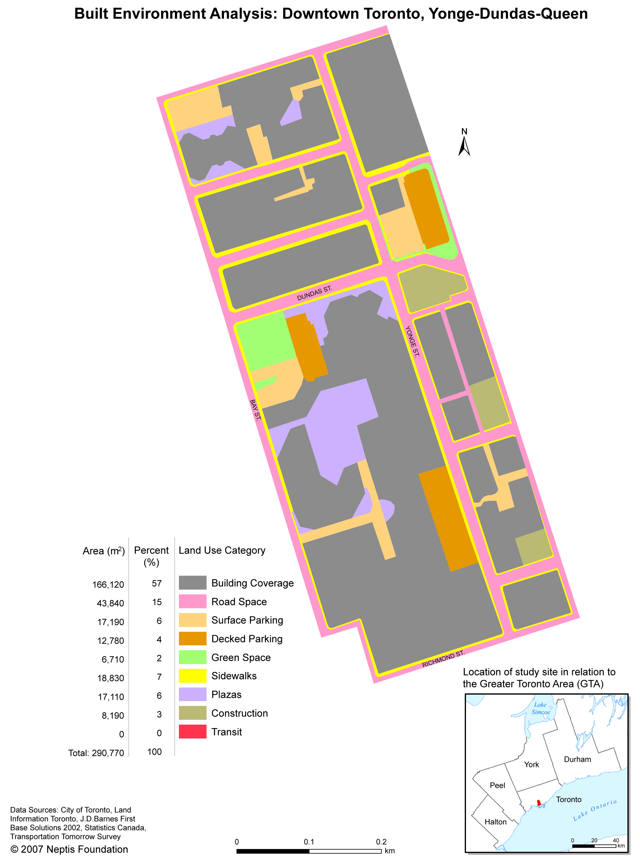
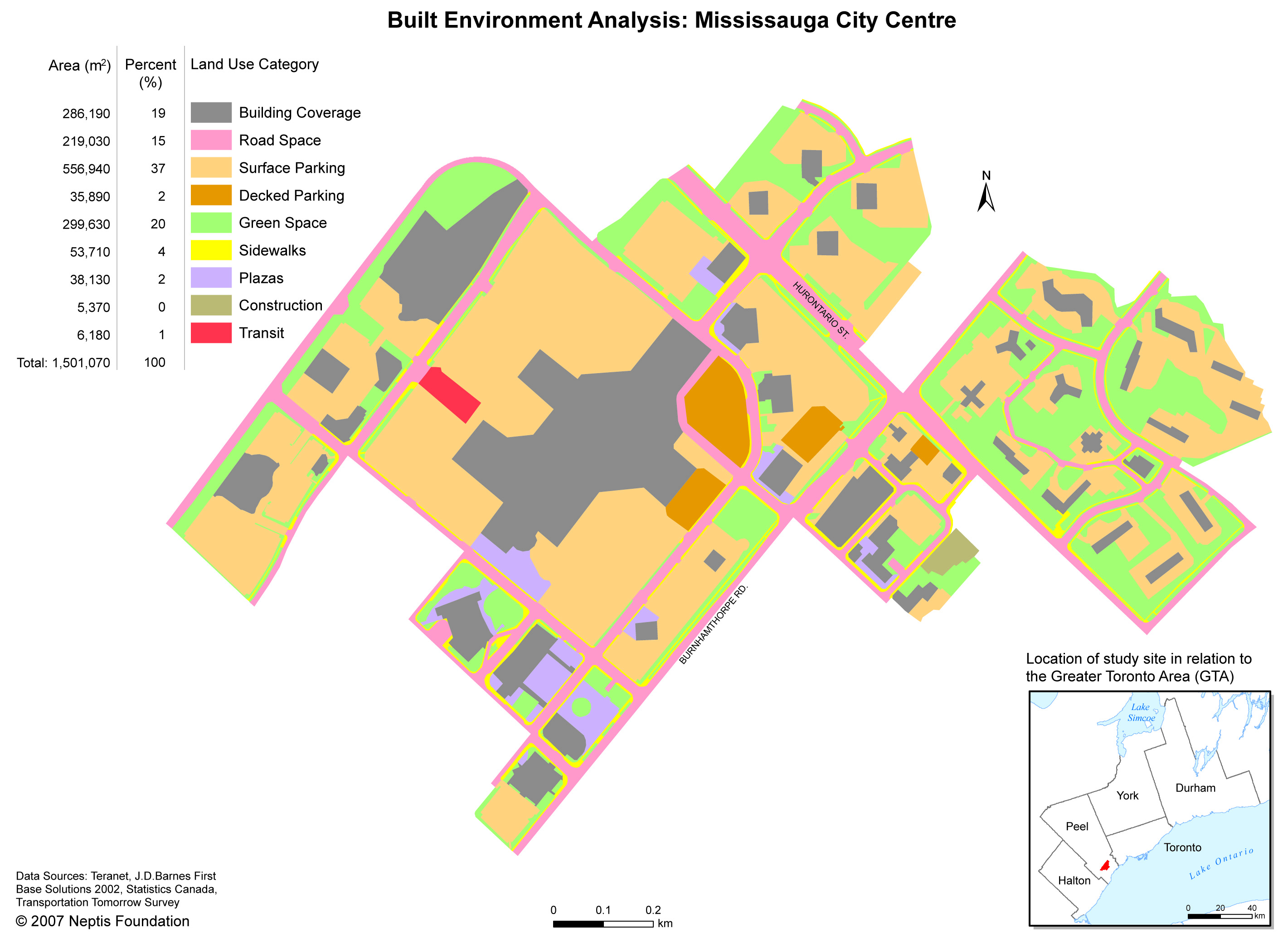
1. The built environment analysis is performed on an area determined through examination of aerial photography and site visits.
2. The socio-economic analysis makes use of census data at the census tract or dissemination area level.
3. The density analysis also makes use of census data, though sometimes with different boundaries than the socio-economic analysis.
4. The travel behaviour analysis, which relies on the University of Toronto's Joint Program in Transportation's Transportation Tomorrow Survey, is defined by Traffic Analysis Zones.